|
Archived from the July 7, 2002 Denver Post Online
No tall tale: State higher than thought
|
|||||
|
By
Steve Lipsher Denver Post Staff Writer |
|||||
|
Sunday, July 07, 2002
- "Mile High City" actually comes up a little short in describing Denver.
Reflecting cartographic accuracy more than geologic uplifting, the latest maps from the U.S. Geological Survey set the official heights of many Colorado landmarks as much as 7 feet higher than before. "You always think of elevations as things that are precisely known and don't change over time," said Jack Reed, a USGS geologist based in Golden. "But these things are always being revised." According to the new calibration, the marker on the 15th step of the state Capitol - bearing the words "One Mile Above Sea Level" - actually is about 3 feet off. People at the Capitol were puzzled as to whether the recalculations would mean moving the brass marker on the west steps. That's because the step etched "One Mile Above Sea Level" was determined to be inaccurate in 1969, and a round brass marker was installed four steps higher showing the "real" mile high. Dan Hopkins, spokesman for Gov. Bill Owens, said the Colorado Historical Society would have to get involved if new mile-high calculations were made necessary by the recalculations. "What about the row of purple seats at Coors Field?" Hopkins asked, referring to the 20th row in the upper deck marking the place where the Rockies baseball stadium reaches 1 mile above the sea. "Does it have to be moved? That's got to be more complicated than moving a marker on the steps. The row of seats is pretty long. "Wouldn't that be a surprise?" Hopkins said with a chuckle. Rockies officials couldn't be reached Friday to say whether they'd take the seats to another level. Mile still measures it To be certain, many points within Denver city limits still can be found at exactly 5,280 feet above sea level, so the folks at the City and County Building don't need to get in a tizzy over creating a new moniker.
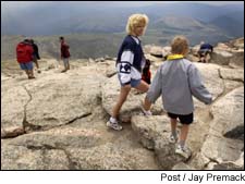
And, because they're more or less uniformly applied, the new elevations actually don't change the rankings of any of the state's 54 14,000-foot peaks, nor does the state claim any additions to the list. Grizzly Peak near Independence Pass, formerly listed at 13,988 feet, still falls short of the threshold. Colorado's highest point, Mount Elbert near Leadville, gained 7 feet to a lofty 14,440 feet above sea level. And Pikes Peak - an internationally renowned landmark long considered to be 14,110 feet - now is listed at 14,115. "They're not really going up," Reed said. "We're just getting better at measuring them." In fact, the new elevations already are being revised through global-positioning satellite technology, which promises someday to provide the most precision yet. "One would assume that the changes will keep getting less and less" as the models gain refinement, Reed said. But prominent mountaineer and guidebook author Gerry Roach points out that four new peaks have been added to the list of thirteeners. "That's exciting," he said, noting that a small but growing list of people, including his wife, Jennifer, had thought they'd climbed all of the peaks above 13,000 feet. Still, he dreads the work ahead of him in revising his books, "Colorado Fourteeners" and "Colorado Thirteeners." "If every altitude of every peak changed, that's a nontrivial editing job," Roach said. "It will change practically every page in the book." West's landscape altered The official revisions actually came about a couple of years ago when Congress formally adopted the National Geodetic Vertical Datum of 1988, but they are showing up on maps only now due to slow bureaucracy. Armed with thousands of benchmarks created since the last comprehensive survey in 1929, the number-crunchers at the National Geodetic Survey recalculated the "geoid," an imaginary surface that represents sea level, hammering out discrepancies that indicated, for example, the Pacific Ocean being higher than the Atlantic. The biggest changes were found in the West, where mountain peaks have been imprecisely measured since the days of the Hayden Survey in the 19th century. "Elevations are tricky' Part of the difficulty has been that mountains, with all of their mass, have a certain amount of gravity that pulls plumb bobs ever so slightly and throws off surveyors' levels, warping the results. And partly, it is the minute errors that add up when surveying from other survey points. "These are extremely small things in the scheme of things ... but across the nation, they do make a difference," said Richard Cohen, the state's adviser to the U.S. Geological Survey. "Saying an elevation is exactly this above sea level . . . well, gosh, sea level is a long ways away. Elevations are tricky, at best." But in all, the latest revisions reflect relatively minor changes even from the calculations of the original surveyors, who did a remarkably good job relying on now-archaic processes such as triangulation. "Most of the surveys I've seen throughout the United States were within a couple of feet, which is fairly remarkable, if you ask me," Cohen said. Aside from recalibration, Colorado's relatively young mountains actually are still growing through geologic uplifting, although the rate is so slow that it is mostly offset by erosion and wouldn't be noticeable over several lifetimes, geologists say. Although she hardly struggled ascending Mount Sherman recently, Marjorie "Mac" Borsina said she fought for every inch above 14,000 feet - including the 7 extra feet added to its official elevation. Borsina, who now has climbed eight fourteeners, said an additional few feet only makes the achievement that much greater. "It's tough at that elevation, no matter if it's 14,000 or 14,002 feet," she said. "It's still over 14,000 feet. The air is thinner up there." You can get elevation details for specific locations by going to the National Geodetic Survey Web site, http://www.ngs.noaa.gov/cgi-bin/ds_radius.prl. You need to supply approximate longitude and latitude and a radius bot get a list of benchmarks in the area you specificied. Clicking on those will give details of location and elevation.
All contents Copyright 2002 The Denver Post or other copyright holders. All rights reserved.
This material may not be published, broadcast, rewritten or redistributed for any commercial purpose.
|